The Ballona Creek Watershed covers about 130 square miles in the coastal plain between the Santa Monica Mountains and Downtown Los Angeles. As shown in the map, before 20th Century urbanization, hundreds of miles of streams carried spring water and rainwater through marshes, ponds, and meadows toward Santa Monica Bay.
During the 20th Century, most area waterways were shunted into underground storm drains so Los Angeles and neighboring cities in the watershed could develop without the threat of flooding. One such waterway, Brown Canyon Creek, funneled water south from 2,400 acres in the Beverly Glen area of the Santa Monica Mountains. In wetter years, its flow reached Ballona Creek and the ocean; other times, it evaporated and sank into porous soils before making it that far. Raised from the storm drain, Brown Canyon Creek is the stream you see before you today. These waters once again feed plants and animals and will be cleaned by natural biological processes on the way to the ocean.
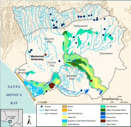
The watershed map above is used here and on the Greenway courtesy of the Southern California Coastal Water Research Project (SCCWRP), a public R&D agency that develops and applies next-generation science to improve management of aquatic systems in Southern California and beyond. Since its founding in 1969, SCCWRP has been developing strategies, tools and technologies that the region’s water-quality management community relies on to more effectively protect and enhance the ecological health of Southern California’s coastal ocean and watersheds.
The map was prepared for SCCWRP’s 2015 Historical Ecology of the Ballona Creek Watershed.
Tour with the Echoes Explorer mobile app at the Greenway or listen now.

Brown Canyon Creek immediately south of the Greenway in May 1939 as it crosses Rancho La Lomita (1919-1939). (Courtesy of Los Angeles Public Library’s Security Pacific National Bank Photo Collection.)
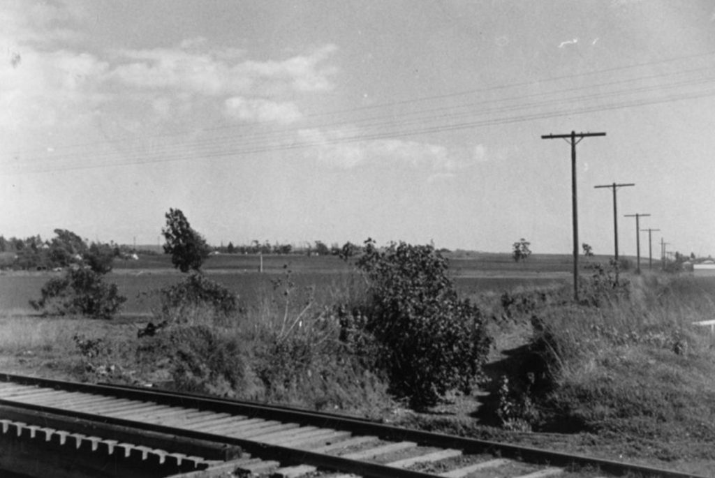
A sign posted at the Greenway mistakes the drainage ditch pictured above as Brown Canyon Creek. But the ditch was one of many surface drainages across the Ballona Watershed. This one, pictured in May 1939, crossed under the railroad tracks east of Kelton Avenue on the western edge of Rancho La Lomita. (Courtesy of Los Angeles Public Library’s Security Pacific National Bank Photo Collection.)