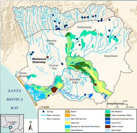
The Ballona Creek Watershed covers about 130 square miles in the coastal plain between the Santa Monica Mountains and Downtown Los Angeles. Before 20th Century urbanization, hundreds of miles of waterways carried spring water and rainwater through marshes, ponds, and meadows toward Santa Monica Bay.
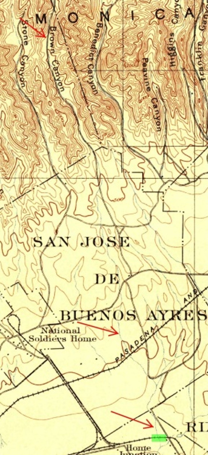
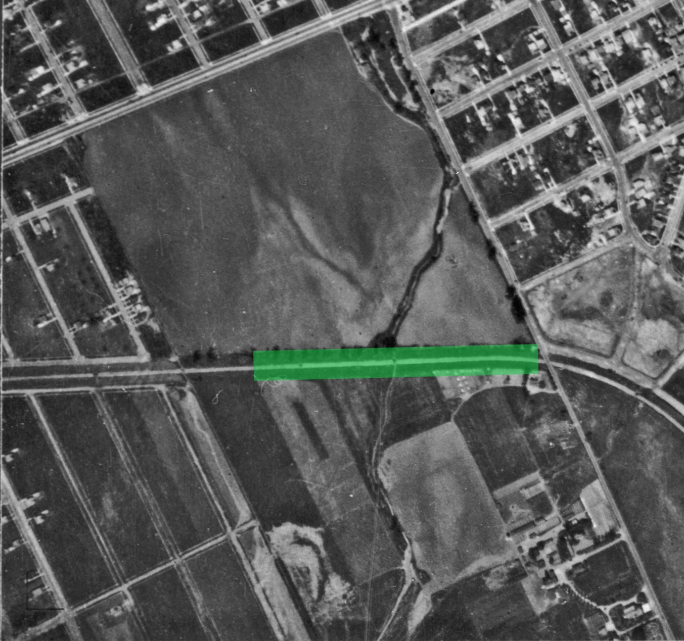
Some of the water one sees at the Westwood Greenway comes from one of the watershed’s buried streams — Brown Canyon Creek — which is fed by a spring in Beverly Glen in the Santa Monica Mountains. In 1913, the United States Geological Survey described it this way: “Brown Canyon Creek; Ballona Creek basin; Los Angeles County; an intermittent stream, about 6½ miles long, draining a small area in the Santa Monica Mountains, and flowing east of south to a point near Palms, where its waters sink.” (Gazetteer of Surface Waters in California.) It is shown on the map below flowing toward, and across, today’s Westwood Greenway.
For untold generations, Brown Canyon Creek shaped life in the canyon and beyond. As Les Rivers notes in his History of Beverly Glen (quoted extensively below), there was “a small village of Indians who lived at the springs, at the head of the Glen, in the general area of Beverly Glen Place.” That was before Francisco Sepúlveda y Redondo “dispossessed them” after receiving the Rancho San Vicente y Santa Mónica land grant in 1839.
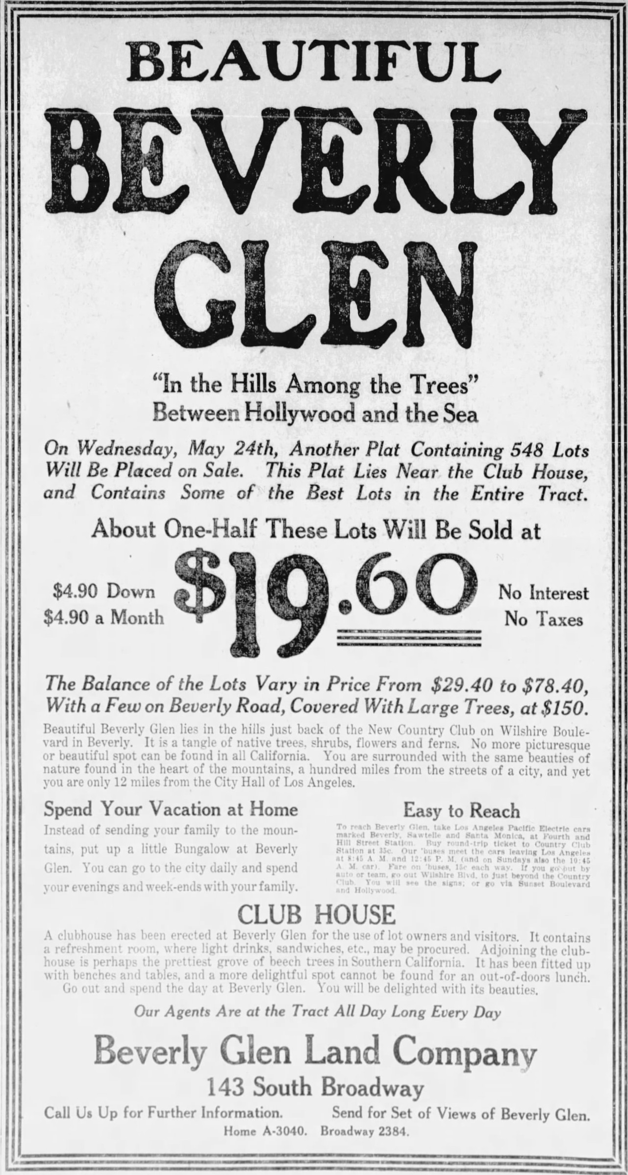
Cornelius Brown homesteaded a ranch north of Sepúlveda’s rancho, covering the area from south of today’s Perdido Lane to today’s Beverly Glen Circle. In 1867, Brown built a wagon road to his ranch, winding “back and forth across the brook, in and out among the trees and rocks of the canyon bed.” That “brook” was called Brown Canyon Creek, and the canyon was called Brown Canyon when Bertram Chapman Mayo came along to develop Beverly Glen around 1909.
Canyon residents from those early years told Les Rivers of “a waterfall that came down over the rocks after every good rain,” and a small creek running along the canyon floor. They relied on shallow wells “in the summer when the brook had run dry.”
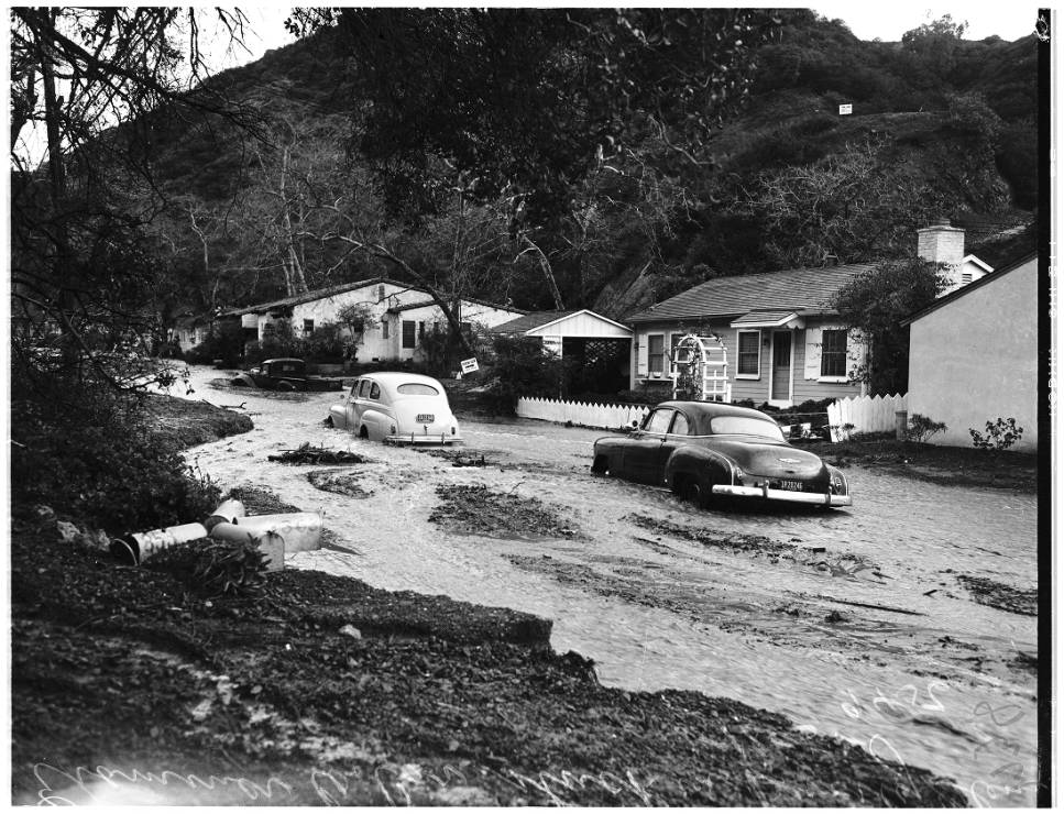
Like most of the Ballona Watershed’s streams, Brown Canyon Creek was shunted into a series of underground storm drains so downstream areas could develop without the threat of flooding. According to a 1915 Los Angeles County flood control study, Brown Canyon Creek had a “possible flood crest of 227 cubic feet per second.”
As Les Rivers tells it, the County built drainage ditches and storm drains in 1916 to redirect the creek: “1916 was the year that the road was finally paved, up to a point just south of the later Four Oaks” at Beverly Glen Boulevard and Beverly Glen Place. “The creek bed was channeled into drainage ditches, and at key points into storm drains, six feet deep and six feet wide, built of reinforced cement.” Rivers quotes Milt Cummings (who worked for Beverly Glen developer Mayo): “When they came in here and poured us a twenty-foot cement road,” said Mr. Cummings, “they poured it on top of these cement drains. Those drains criss-cross back and forth under the road, big enough for a full-grown man to walk in. Under the surface of Beverly Glen Boulevard,” said Mr. Cummings, “we have these old catacombs to rival Rome, these old sewers to rival the ones under Paris.”
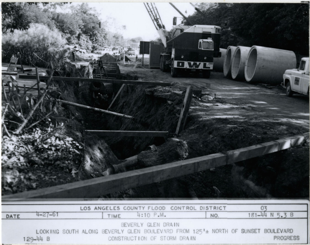
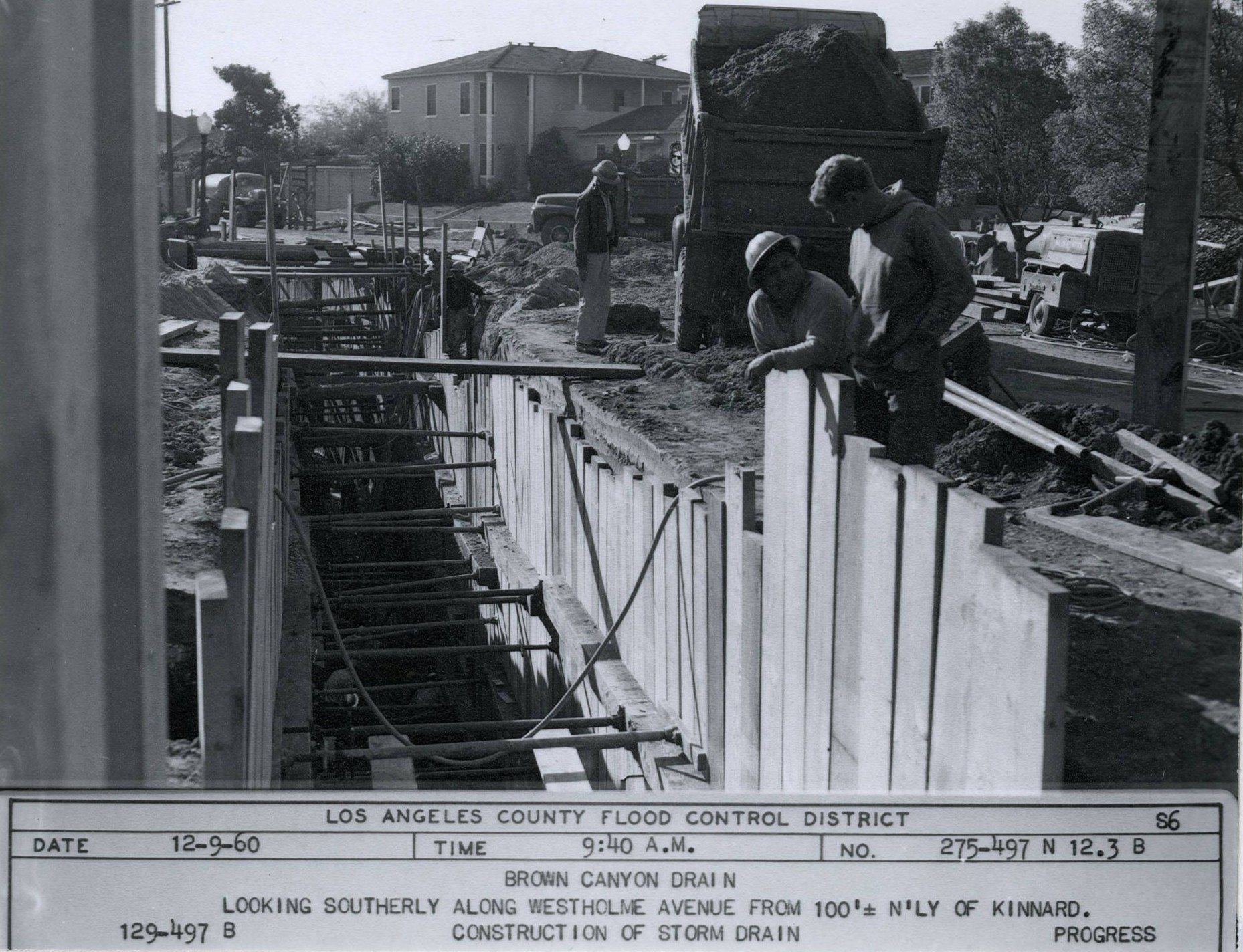
Once the City of Los Angeles annexed the canyon in 1925, additional storm‑drain segments were built in 1927 and 1929 along Beverly Glen Place by the creek’s headwaters. After flooding in the 1950s, the County bolstered its storm drains along Beverly Glen.
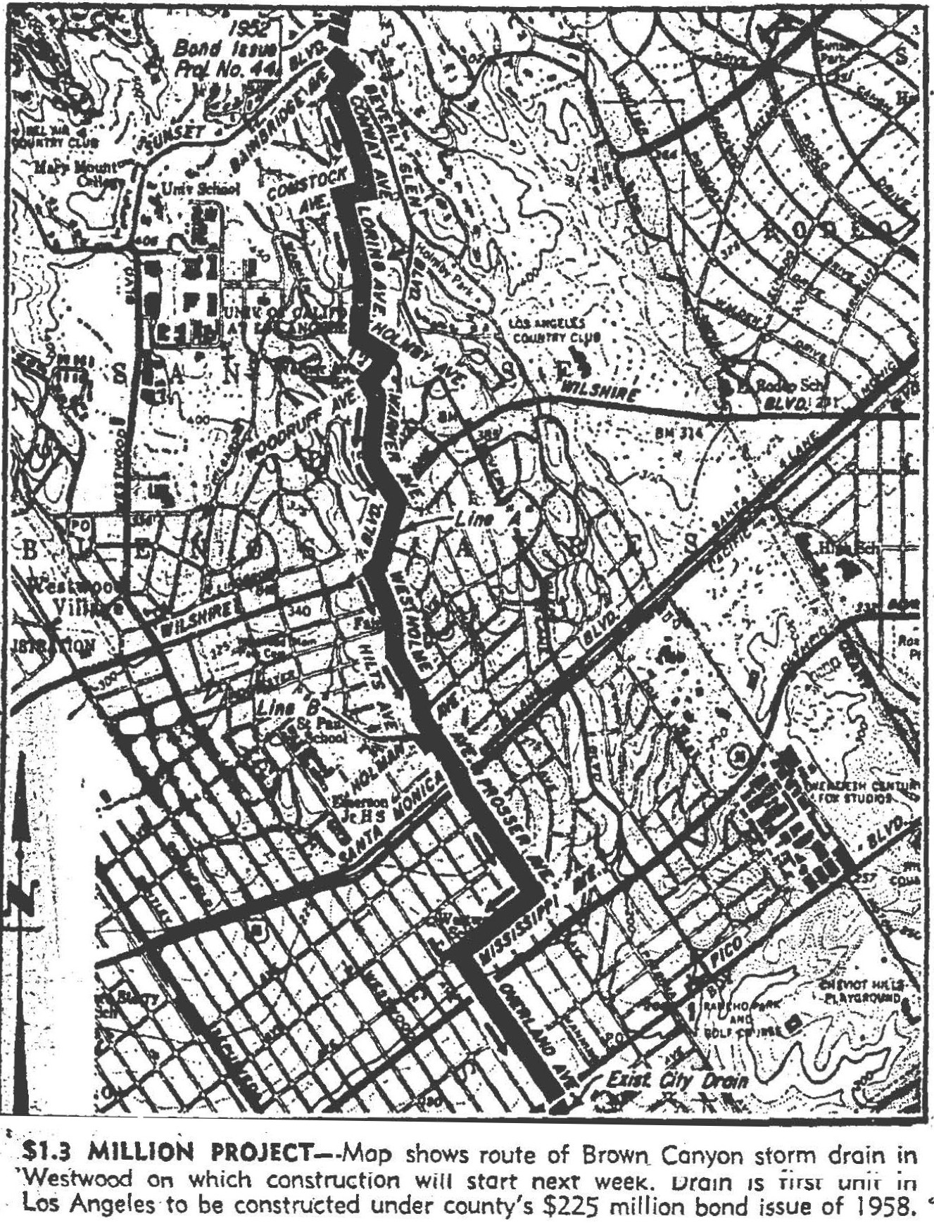
In 1960, the LA Times reported that the planned Beverly Glen storm drain would “connect at Sunset with [the] Brown Canyon storm drain, upon which work was started at Pico Blvd. and Overland Ave.”
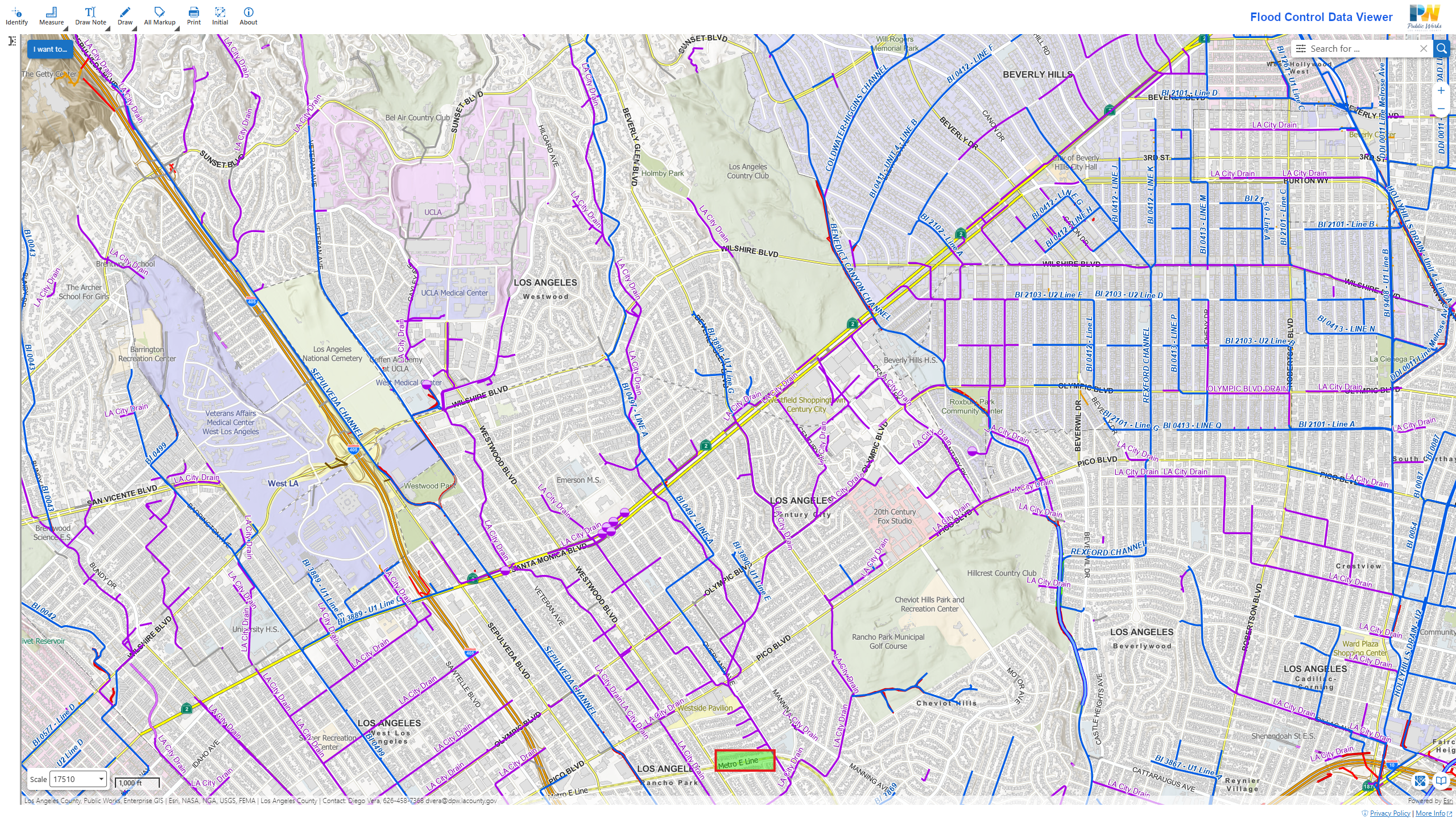
The watershed’s buried streams carry pollutants washed from catch basins and street gutters into the network of storm drains that join the Beverly Glen and Brown Canyon systems and ultimately feed the Overland Avenue Storm Drain. In 2006, studies showed that the system in the Greenway area was an “impaired waterway,” carrying trash, sediment, and elevated levels of copper, lead, zinc, and fecal bacteria — pollutants that flowed untreated into Ballona Creek and the ocean. That was the genesis of the Westwood Greenway’s engineered, bio-remediation stream which brings Brown Canyon Creek’s water to where it crosses and then rejoins (further south) some of its historic course.
To clean that water (in order to help comply with the Federal Clean Water Act’s requirements) water from the Overland Avenue Storm Drain is diverted into an engineered stream where trash and sediment are removed before natural biological processes clean the water. Along the way, these waters once again support plants and wildlife and replenish the aquifer as it percolates into the soil.
The watershed map at top and in the tool below is used courtesy of the Southern California Coastal Water Research Project (SCCWRP), a public R&D agency that develops and applies next-generation science to improve management of aquatic systems in Southern California and beyond. Since its founding in 1969, SCCWRP has been developing strategies, tools and technologies that the region’s water-quality management community relies on to more effectively protect and enhance the ecological health of Southern California’s coastal ocean and watersheds.
The map was prepared for SCCWRP’s 2015 Historical Ecology of the Ballona Creek Watershed. The study’s authors missed mapping the Beverly Glen springs.
Tour with the Echoes Explorer mobile app at the Greenway or listen now.